Comprehensive high-resolution data to climate-proof your future
The pace and complexity of climate proofing have accelerated.
High-resolution data integration is now the baseline for robust decision making.

360° High-res climate proofing solutions
A tailored and integrable multi-hazard data suite to meet today's climate challenges.

Discover our Climate Data portal
Our SaaS platform turns climate science into operational decisions, site by site. In just a few minutes, configure a multi-hazard, multi-scenario analysis for your assets, then receive an auditable exposure report in under 24 hours.
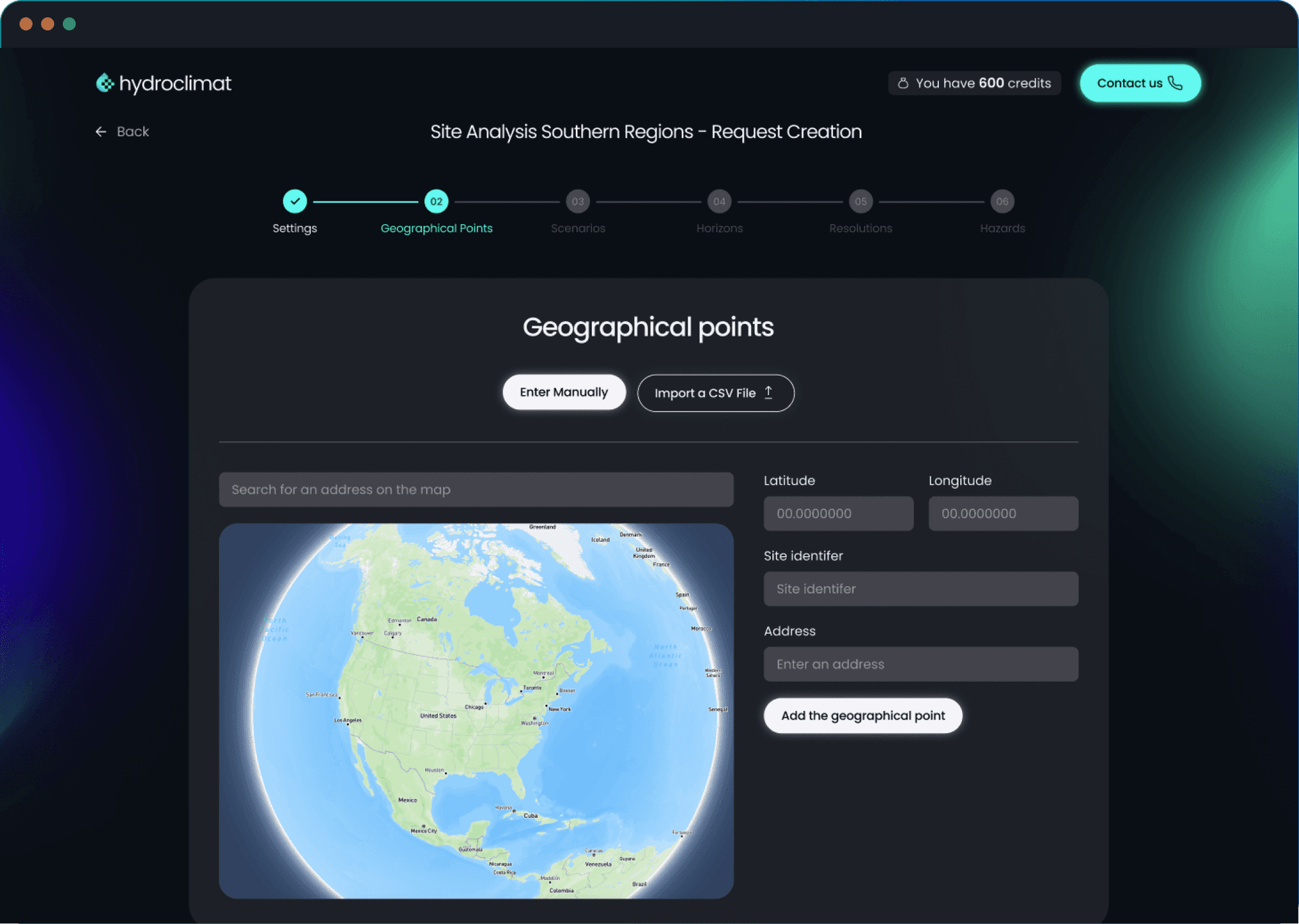
Our application scenarios

Rising flood risks from climate change. Traditional models miss local exposure. High-resolution data is crucial.
Custom high-resolution data:

Many plans still rely on outdated baselines, missing the local precision needed for future-proof infrastructure.
High-resolution, long-term climate & hydrological models:

Large organizations face rising disclosure demands (CSRD, SFDR, TCFD…), but reliable standardized indicators across sites remain scarce.
We support large organizations in optimizing their climate reporting through:
Trusted by leading organisations in insurance, infrastructure, and climate-sensitive sectors.


Our application scenarios
Rising flood risks from climate change. Traditional models miss local exposure. High-resolution data is crucial.
Custom high-resolution data:
Many plans still rely on outdated baselines, missing the local precision needed for future-proof infrastructure.
High-resolution, long-term climate & hydrological models:
Large organizations face rising disclosure demands (CSRD, SFDR, TCFD…), but reliable standardized indicators across sites remain scarce.
We support large organizations in optimizing their climate reporting through:
Trusted by leading organisations in insurance, infrastructure, and climate-sensitive sectors.
Locally Grounded
Scientifically Backed
Ready to Integrate


What our clients say
"Our water management projects depend on precise climate data. Hydroclimat's long-term projections help us site infrastructure appropriately and plan sustainable resource."
"For the insurance sector, accurate flood and climate projections are essential. Hydroclimat provides us with robust indicators that strengthen both our risk models and our pricing strategies."
"Infrastructure resilience is at the heart of our operations. Thanks to Hydroclimat, we can anticipate extreme weather impacts on our networks and design more reliable adaptation plans."
"Hydroclimat's high-resolution datasets integrate seamlessly with our GIS solutions, giving our clients a clearer view of local climate risks and enabling more precise spatial analysis."
We are backed by strategic investors &
trusted insurance leaders dedicated to
advancing climate risk intelligence.


Better climate
decisions start here.

